
The Tour de France has made legends of mountains. For over a century, the race has returned to the same cols again and again -the Tourmalet, the Galibier, Alpe d'Huez, Ventoux -where history was written and careers defined. These are the climbs every cycling fan knows by name, and many dream of riding one day.
Below we've chosen 15 legendary cols that the Tour has visited frequently and where memorable things have happened. For each you'll find why it's epic, a brief description of statistics and the route to the top, how to get there, and practical tips. Whether you're planning a pilgrimage or just love the stories, these are the mountains that define the Tour.
Pyrenees
Col du Tourmalet
Why it's legendary
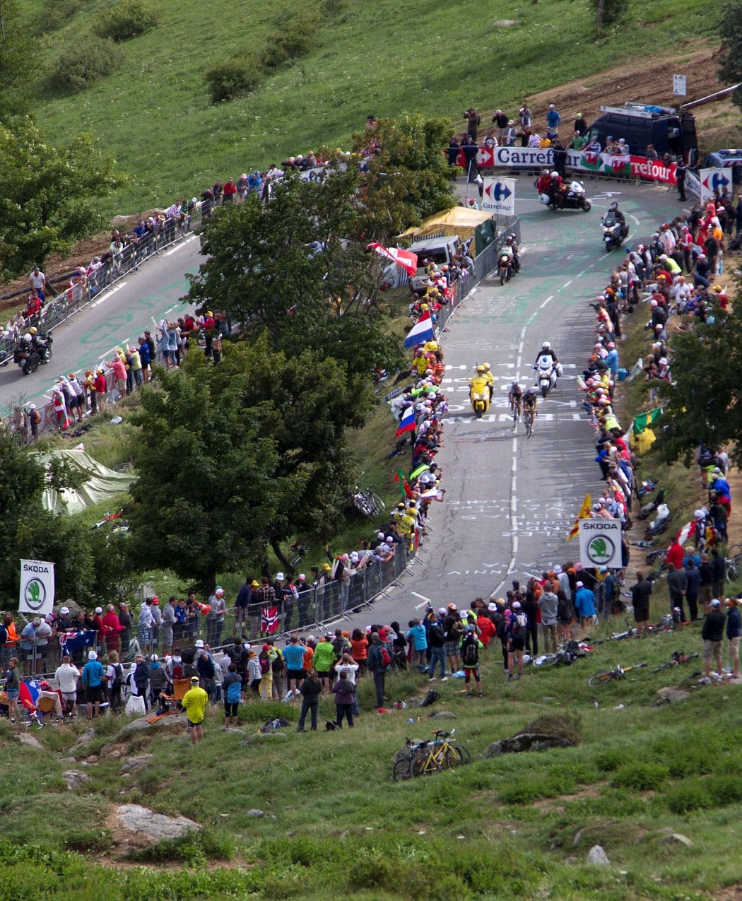
The Tourmalet is not just a climb -it's the founding myth of the Tour de France. In 1910, Henri Desgrange sent his riders across it on dirt tracks meant for shepherds, and at the summit Octave Lapize delivered the line that every cyclist now knows: 'Vous êtes des assassins!' More than a century later the Tour has crossed it 89 times -more than any other pass in history -and the Géant du Tourmalet, a silver cyclist in full-out sprint, still marks the summit every winter when the real one is locked away under snow. The west side starts in Luz-Saint-Sauveur, deep in spa country; the east begins in Sainte-Marie-de-Campan, where a blacksmith once watched a man fix his own fork with a child pumping the bellows. Everything about the Tourmalet is oversized: the history, the gradient, the wind, the reputation. Every great Tour rider has left blood here -Lapize, Christophe, Coppi, Bahamontes, Merckx, Hinault, Indurain, Contador.
Moments on the mountain
- 1910'Assassins!'
Octave Lapize crests first in the Tour's first high-mountain stage and hurls the word that every cyclist knows at the organisers waiting at the summit.
- 1913The forge at Sainte-Marie
Eugène Christophe snaps his fork on the descent, walks 10 km down to the village, and forges a new one himself. A boy works the bellows, which breaches the rules -Christophe is docked minutes he never recovers.
- 1969The Merckx monologue
Eddy Merckx attacks alone on the Tourmalet and rides 130 km solo to Mourenx, winning the stage by nearly 8 minutes on his way to his first Tour.
- 2010Schleck v Contador in the fog
On the first-ever summit finish at the Tourmalet in the modern Tour, Andy Schleck attacks Alberto Contador five times in the final 4 km. Contador counters every move. They cross the line together in driving rain; the 8-second gap between them in Paris is built exactly here.
The numbers
Two Hors Catégorie sides, both 17–19 km. East from Sainte-Marie-de-Campan: 4 km gentle warm-up along the river, then the gradient tilts over 7% all the way to La Mongie. Above the ski station the last 4 km are the worst -9–10% through the scree, fully exposed, with the summit hut always somehow further than it looks. West from Luz-Saint-Sauveur: longer, slightly steeper on average. After Barèges the road opens out and the final 6 km climb a natural amphitheatre with the Pic du Midi radar dome glowing white on your right. The summit itself is a saddle between two ridges; the Géant statue stands on a plinth above the car park, the Souvenir Jacques Goddet memorial below.
How to get there
Trains to Lourdes or Tarbes (Paris–Lourdes TGV takes roughly 6 hours), then ~45 min by car or the occasional SNCF bus to Luz-Saint-Sauveur or Bagnères-de-Bigorre. Flights: Toulouse (~2 h) or Pau (~1 h 30). The col is on the D918; from late May to mid-October it's open, outside that the Géant statue is removed and the pass shut for snow. Campan, Luz, and La Mongie all have budget hotels that fill up fast in July.
Tips: Start before 08:00 in July -after 10:00 the tour buses grinding up to La Mongie turn the road into a diesel parade. Carry 1.5 L of water minimum on the east side; there's a fountain at La Mongie and one at the summit café, but nothing reliable between. Gearing: 34×30 is the floor, 34×32 is civilised, anything less will cost you on the last 4 km. A fit amateur is looking at 1h45–2h30; the pros do it in 48–55 minutes. The descent off the west side is wide and fast -watch for gravel on the outside of hairpins after rain. If you've got the legs, link it with the Col d'Aspin and Col du Peyresourde for the classic Circle of Death (115 km, ~3,500 m of climbing) -the same loop the Tour first rode in 1910, which is the whole point.
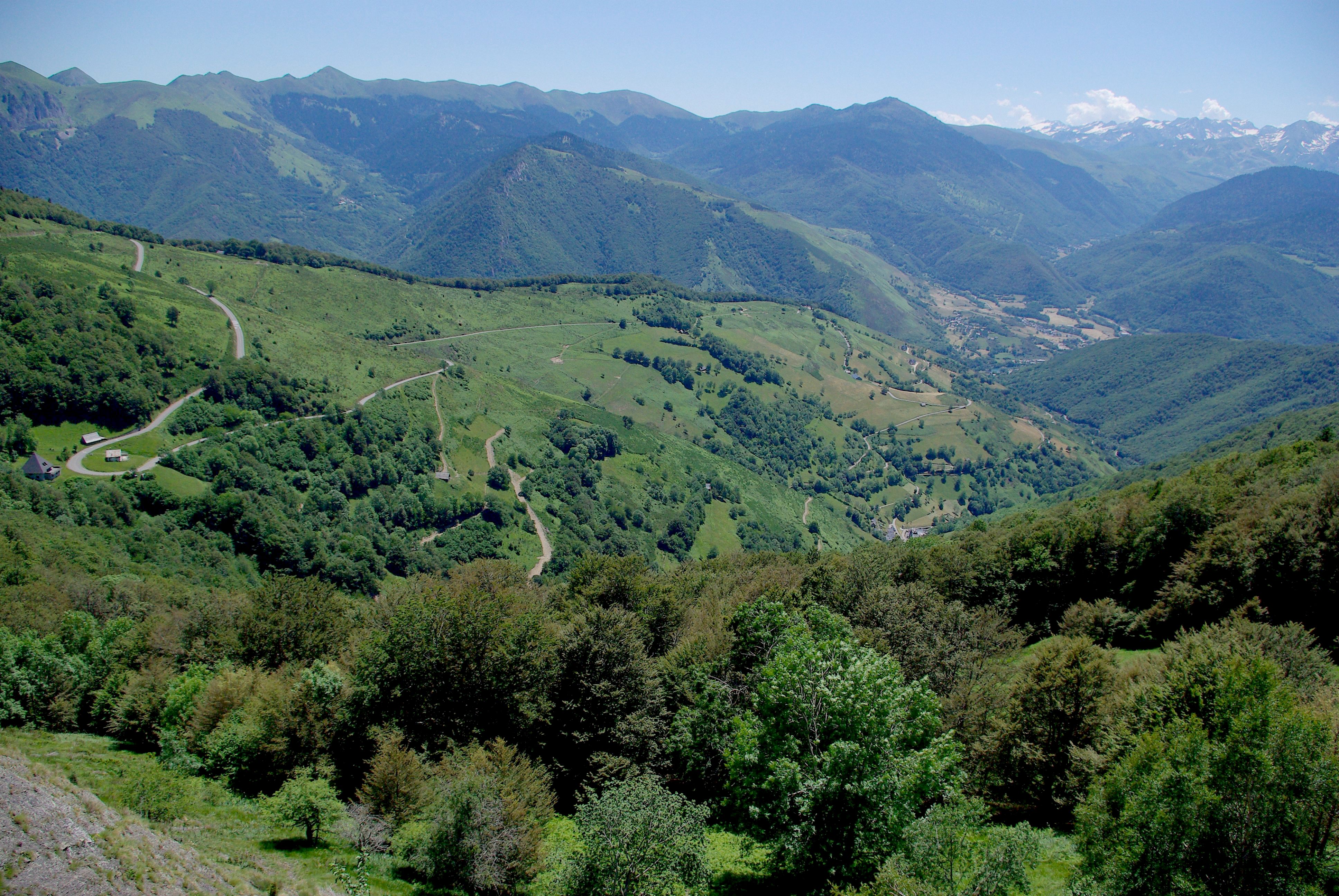
Col d'Aubisque
Why it's legendary
The Aubisque is the soul of the Pyrenean Tour -part of the historic 'Circle of Death' with Tourmalet, Aspin, and Peyresourde. The road clings to the side of the mountain above the Cirque du Litor, with drops that make you focus. It has been in the Tour since 1910 and has seen countless breakaways and GC battles.
Moments on the mountain
- 1910The first Circle of Death
The Aubisque is on the route the day the Tour first crosses the high Pyrenees: 326 km, five cols, some on dirt tracks, and riders arriving 8 hours after the leader.
- 1951Robic drops into the Cirque
Jean Robic crashes into a ravine on the Aubisque descent, climbs back up, demands a new wheel, and carries on. Pyrenean stages used to be like this.
- 2007Rasmussen's last stand
Michael Rasmussen wins atop the Aubisque in the yellow jersey. That night, his team pulls him out of the race. The Tour explodes.
The numbers
From Laruns (west): 16.6 km, the classic side -steady climb with the spectacular section above the Cirque du Litor. From Argelès-Gazost (east): longer, gentler average but a big day when combined with Col du Soulor (often ridden together as Aubisque–Soulor).
How to get there
Pau or Laruns. Pau has an airport and is the gateway to the western Pyrenees. The D918 (Laruns side) and D126 lead to the col.
Tips: The balcony section can feel exposed; if you're nervous about heights, stay focused on the wheel in front. Often combined with Soulor, Tourmalet, or Peyresourde in a mega-Pyrenean day.
Col du Peyresourde
Why it's legendary
The Peyresourde is the 'friendly' giant of the Pyrenees -still a proper climb but with a more regular gradient than some of its neighbours. It's been in the Tour since 1910 and often appears in the middle of a multi-col stage. The descent toward Bagnères-de-Luchon is fast and technical.
Moments on the mountain
- 1910Charter member of the Circle of Death
Featured in the Tour's first high-mountain stage alongside Aubisque, Tourmalet and Aspin. Over a century later, it's still part of the route most summers.
- 2016Froome descends sitting on his top tube
Chris Froome attacks off the Peyresourde summit, then drapes himself over his top tube in an aero tuck and rails the descent to Luz-Ardiden. A nerd move so weird it became a rule change.
- 2020Hirschi nearly
Marc Hirschi solos off the Peyresourde and is reeled in inside the last kilometre -the first of three agonising second places that Tour before he finally won a stage.
The numbers
From Bagnères-de-Luchon (east): 9.7 km, the shorter side -good gradient, tree-lined. From the west (Bagnères-de-Bigorre side): 15.3 km, longer and more open. Both are Category 1 in the Tour.
How to get there
Bagnères-de-Luchon or Bagnères-de-Bigorre. Luchon is a classic Tour town. Toulouse airport is about 1.5–2 hours. D618 and D125 serve the col.
Tips: Often ridden as part of a loop with Aspin, Tourmalet, or Port de Balès. The Luchon side is the one most often used in the Tour for the final approach.
Col d'Aspin
Why it's legendary
The Aspin is the 'easiest' of the great Pyrenean cols but don't underestimate it -it's still 12 km of climbing and has been in the Tour since 1910. It's often used as a warm-up before the Tourmalet, and the pastoral scenery on the Sainte-Marie side is some of the prettiest in the Pyrenees.
Moments on the mountain
- 1910The dirt-track version
On the first high-mountain stage, the Aspin was ridden on a rough track that doubled as a cow path. Cows included -at the summit, riders reportedly had to push their way through the herd.
- 2002Virenque's last hurrah
Richard Virenque attacks on the Aspin in his final polka-dot-jersey campaign, soloing over the top to win a stage to Bagnères-de-Luchon on Bastille Day.
- 1959The Eagle of Toledo
Federico Bahamontes -the 'Eagle of Toledo', six-time King of the Mountains and the first Spaniard to win the Tour -crests the Aspin solo on his way to yellow. Legend says he once stopped mid-descent to eat an ice cream while waiting for rivals, so little did he trust his own descending.
The numbers
From Sainte-Marie-de-Campan (west): 12.8 km, the more frequently used side in the Tour -winding through pasture and forest. From Arreau (east): 12.4 km, similar character. Both are Category 1.
How to get there
Campan, Arreau, or Bagnères-de-Bigorre. Same area as the Tourmalet; the D918 crosses the Aspin (Col d'Aspin) between the two valleys.
Tips: Ideal as the first col of the day before the Tourmalet. The Sainte-Marie side is the one the Tour usually climbs before heading to La Mongie and the Tourmalet.
Alps
Alpe d'Huez
Why it's legendary
The 21 hairpins. The Dutch Corner. The first high-altitude summit finish in Tour history (1952, Fausto Coppi). Alpe d'Huez is the most recognisable climb in cycling -a wall of switchbacks visible from the valley, each bend numbered and named after a stage winner. When the Tour comes here, the road is a river of fans; when it doesn't, it's still one of the world's most ridden climbs. The winner on Alpe d'Huez has often gone on to win the Tour.
Moments on the mountain
- 1952Coppi invents the summit finish
Fausto Coppi wins the Tour's first-ever high-altitude summit finish. Alpe d'Huez then disappears from the race for 24 years -unfashionable, too steep, too far off the motorway.
- 1986La Vie Claire hand in hand
Hinault attacks all day, LeMond follows every move. They cross the line together, Hinault a bike-length ahead. Behind the scenes, nobody is quite sure who was playing whom -and Hinault has never stopped insisting he 'let' LeMond win.
- 1989Dutch Corner is born
Bend 7 gets claimed by Dutch fans who pitch up in orange wigs, orange beer, orange everything -because Dutch riders (Kuiper, Winnen, Zoetemelk, Rooks, Theunisse) had won the stage six times in the previous decade. Forty years on, the corner is still a roaring, drunken orange circus every time the Tour visits.
- 1997Pantani's 37:35
Il Pirata rips the bandanna off his bald head, throws it in his rival's face, and climbs the 13.8 km in 37:35 -an all-time record that's still standing three decades and a hundred doping scandals later.
- 2022Pidcock comes down the Galibier at 100 km/h
22 years old, two minutes behind the break over the Galibier. Tom Pidcock descends like a maniac (a Garmin later clocks him at 101 km/h), catches the break, drops it, and becomes the youngest winner on the Alpe.
The numbers
One main road from Le Bourg-d'Oisans: 21 numbered hairpins from 21 at the bottom to 1 at the top. The first few kilometres are the steepest (around 10–11%); the middle section eases slightly before the final ramps. Each bend has a sign with the name of a Tour stage winner. The road is wide and well surfaced; in July it's packed with spectators.
How to get there
Grenoble is the nearest city (about 45 minutes); Lyon and Geneva airports are both around 2 hours. Le Bourg-d'Oisans is the gateway village at the foot of the climb. Easy to reach via the N91 from Grenoble.
Tips: Ride early in summer -the first 3 km out of Le Bourg d'Oisans are the hottest on the climb and average 10%. Expect 1h15–1h45 for the 13.8 km if you're a fit amateur; pros do it in under 40 minutes. A 34x28 is the minimum; 34x30/32 if you've had a hard day. Water fountains at most bends and cafés in the village at the top. Consider the alternative ascent via Villard-Reculas (longer, quieter) or combine with Col de la Croix de Fer or Col du Glandon for a monster day.
Col du Galibier
Why it's legendary
For decades the highest point the Tour de France had ever reached. The Galibier is the gateway between the north and south of the Alps -a vast, exposed summit at 2,642 m where the race has been decided again and again. Coppi, Merckx, and Pantani have all attacked here. The tunnel at the top (when open) shortens the climb; the original pass goes over the roof. Either way, crossing the Galibier feels like entering cycling's hall of fame.
Moments on the mountain
- 1952Coppi's 92 km solo
Fausto Coppi attacks on the Galibier and rides alone over the Croix de Fer, Galibier and Montgenèvre to Sestriere, winning by 7 minutes. 'Un Martien à bicyclette,' says Géminiani.
- 1998Pantani in the rain
Pantani drops Jan Ullrich in a snowstorm on the descent, rides alone to Les Deux Alpes, and puts nine minutes into the yellow jersey -one of the biggest single-stage swings in modern Tour history.
- 2011Andy Schleck, 60 km alone
Schleck attacks on the Izoard and solos over the Galibier to the summit finish, the highest stage finish in Tour history at the time. He still loses the Tour by 39 seconds in the Grenoble TT.
The numbers
From Valloire (north): 17.7 km of steady climbing; the final 8 km above the tree line are the most spectacular. From Saint-Michel-de-Maurienne you first climb the Col du Télégraphe (12 km, ~7%), then descend to Valloire and climb the Galibier -the classic 'Télégraphe–Galibier' double. The summit can be via the tunnel (2,642 m) or the old road over the top (2,556 m to the monument). Check which is open.
How to get there
Saint-Jean-de-Maurienne or Modane for trains; Grenoble or Chambéry airports. Valloire is a ski resort; Saint-Michel-de-Maurienne is on the N6. The col is on the D902; open roughly June–October.
Tips: The full Télégraphe–Galibier from St-Michel is one of the great Alpine days. Weather can change fast at the top -pack a jacket. The Galibier is often closed until late June.
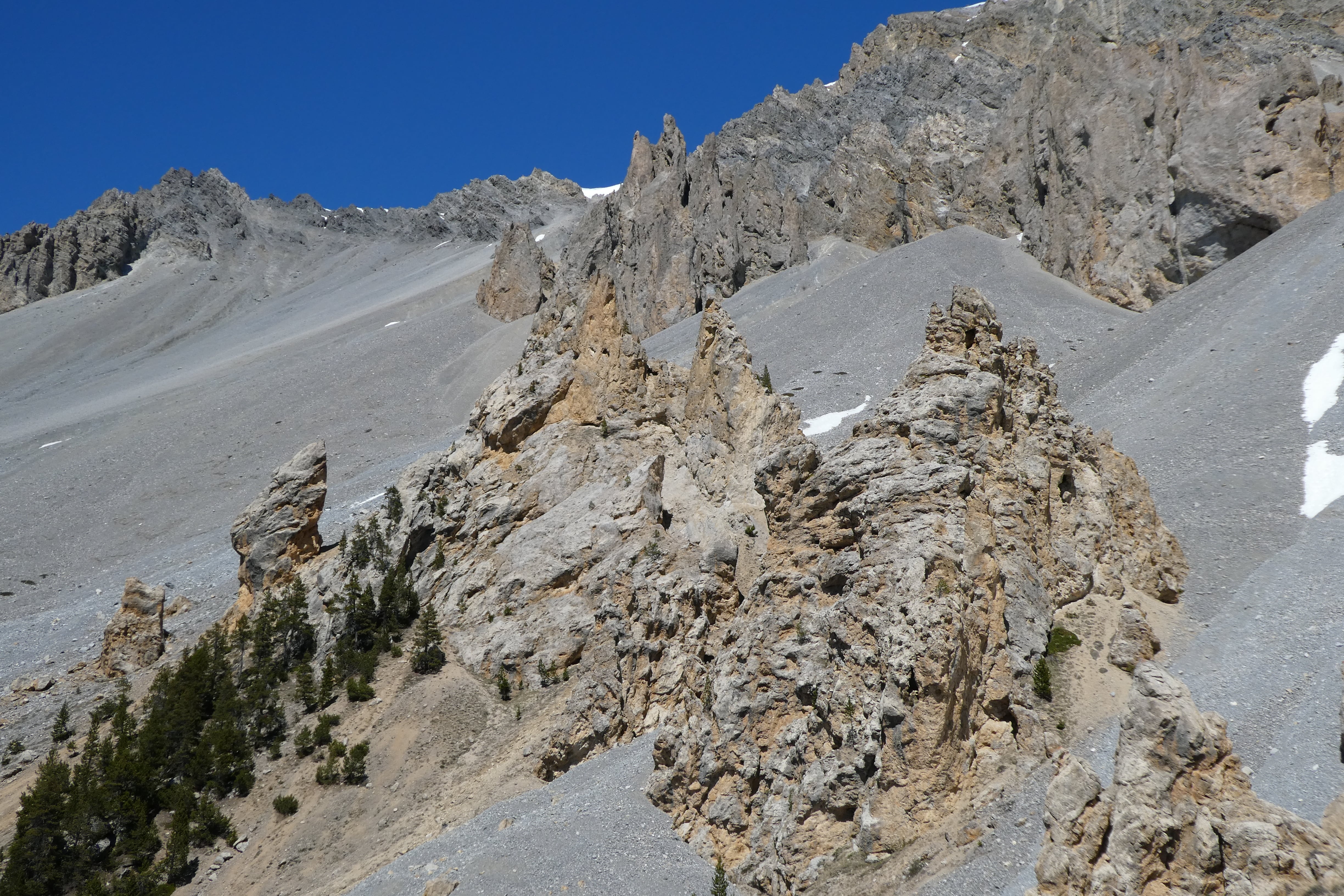
Col d'Izoard
Why it's legendary
The Casse Déserte -a barren, otherworldly stretch of rock and scree between the trees and the summit -makes the Izoard unlike any other climb. Coppi and Bobet duelled here in the 1950s; the Tour has returned again and again. The south side's lunar landscape is one of the most photographed scenes in cycling.
Moments on the mountain
- 1953Coppi and Bobet in the Casse Déserte
Louison Bobet attacks Coppi in the rock spires of the Casse Déserte and rides away to his first Tour. A memorial to both men now stands where the duel played out.
- 1975Thévenet breaks Merckx
Bernard Thévenet distances a struggling Eddy Merckx on the Izoard, flies over the top, and wins in Serre-Chevalier. The Cannibal's five-year stranglehold on the Tour is over.
- 2017Barguil at home
Warren Barguil wins the first summit finish ever on the Izoard on Bastille Day, with the French crowd going feral. The polka-dot jersey and a perfect French afternoon.
The numbers
From Briançon (north): long, steady climb with the Casse Déserte in the final third -a 2 km stretch of rock and dust that feels like another planet. From Guillestre (south): shorter and steeper, also passing through the Casse Déserte before the summit. Both sides are stunning.
How to get there
Briançon (north) or Guillestre (south). Briançon is on the train line from Gap and has good road links. Nice and Grenoble airports are about 2–2.5 hours. The col is on the D902.
Tips: The Casse Déserte is often cooler and windier -layer up. Combine with Col du Galibier (from Briançon) for a legendary double. Best ridden in summer when the road is fully open.
Col de la Croix de Fer
Why it's legendary
The Iron Cross. A long, varied climb that often appears in the Tour in combination with the Glandon or other Alpine giants. It's not the steepest, but the length and the fact that it's usually part of a multi-col day make it a true test. The summit is marked by a large iron cross and views over the surrounding peaks.
Moments on the mountain
- 1986The approach to the Alpe
Hinault and LeMond's legendary hand-in-hand stage to Alpe d'Huez came over the Croix de Fer first, setting up the drama that played out 30 km later.
- 2012Froome's first
A young Chris Froome sets the pace here in service of Wiggins, dropping everyone except his leader -the moment Sky realised they had two Tour winners on the same team.
- 2023Gall's daring solo
Felix Gall attacks on the Croix de Fer descent, takes Pello Bilbao with him, and rides to the first WorldTour win of his career in Courchevel.
The numbers
From Rivier-d'Allemond (north, near Alpe d'Huez): 29 km of climbing with a flatter section in the middle past the Lac du Verney -don't be fooled, the last 10 km bite. From Saint-Jean-de-Maurienne (south): 22.4 km, more consistent gradient. The summit is shared with the Col du Glandon (same pass, different names on each side).
How to get there
Grenoble or Saint-Jean-de-Maurienne. The north side starts near Alpe d'Huez and the Romanche valley; the south from the Maurienne. D926 from the north, D927 from the south.
Tips: Often ridden with Glandon (same summit from different valleys) or as part of a loop including Alpe d'Huez. Long day -pace yourself and carry food.
Col du Glandon
Why it's legendary
The Glandon is the harder sibling of the Croix de Fer -steeper, more relentless, and a Tour favourite when the route wants to hurt the peloton. The climb from the Maurienne side is savage in places, with sustained sections over 10%. The summit is the same pass as the Croix de Fer but the Glandon side is the one that breaks legs.
Moments on the mountain
- 1977Thévenet again
The Glandon features in Bernard Thévenet's second Tour win, deep in the Alpine stages that confirmed France's late-70s golden moment.
- 2015Nibali flies to La Toussuire
Vincenzo Nibali attacks on the Glandon descent and takes back enough time to stay on the podium -classic dagger-in-the-dark bike handling from the Italian.
- 2022Vingegaard cracks Pogačar
The Glandon is the warm-up act for the Granon stage that blew the Tour apart. Jumbo-Visma set a pace here that left Pogačar with empty legs before the real summit finish.
The numbers
From Saint-Étienne-de-Cuines (Maurienne): 21.4 km with a very tough final 8 km -long stretches at 9–10%. From Rivier-d'Allemond: similar length, slightly gentler average but still hard. The last kilometres to the col are shared with Croix de Fer traffic.
How to get there
Saint-Jean-de-Maurienne or the Romanche valley (for the north). Same area as Croix de Fer; combine both in one ride.
Tips: If doing Croix de Fer and Glandon in one day, choose your order based on where you're staying. The Maurienne side of the Glandon is the steepest.
Col du Télégraphe
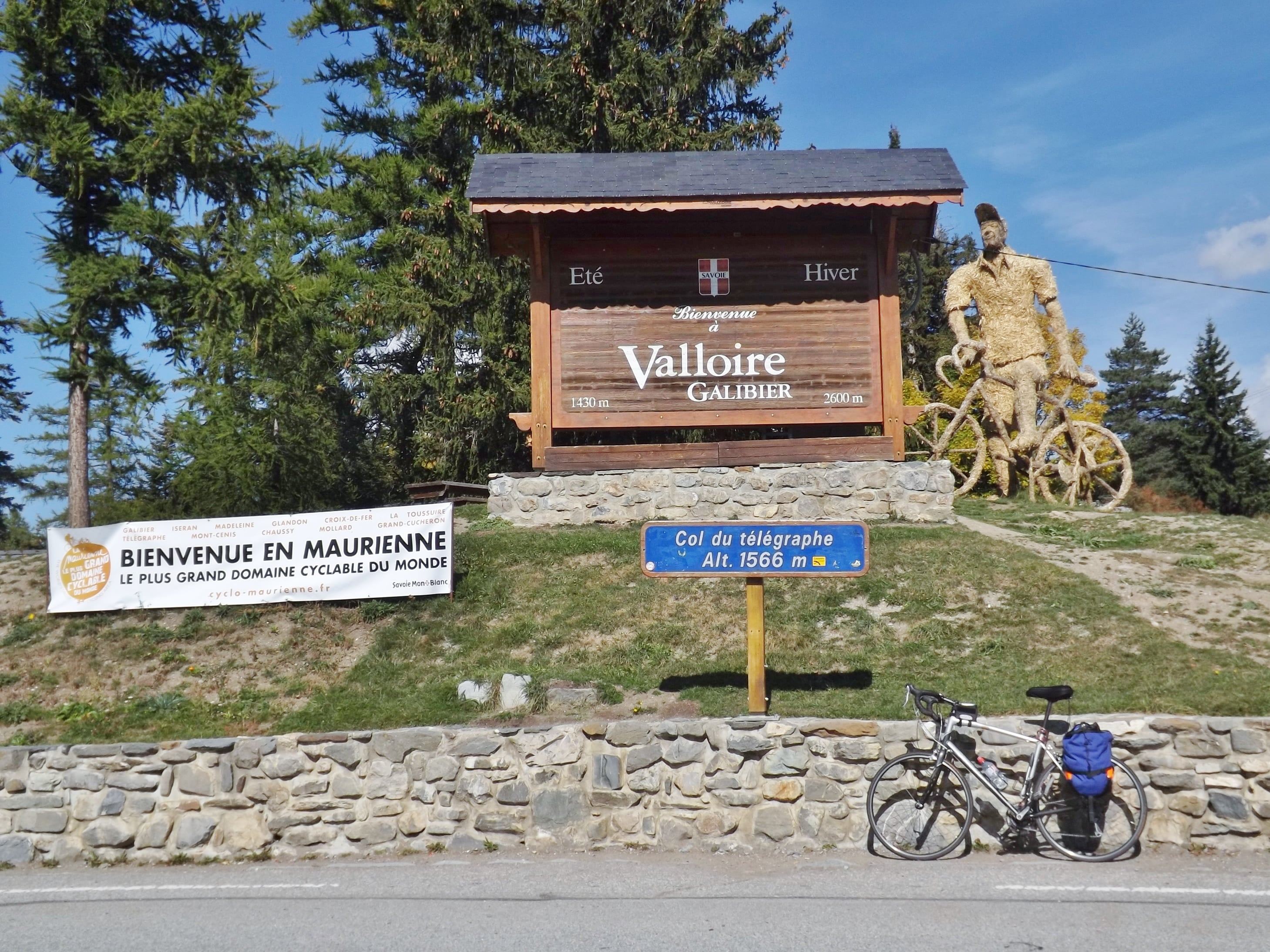
Why it's legendary
The Télégraphe is rarely ridden alone -it's the appetiser before the Galibier. But that doesn't make it easy: 12 km at around 7% from Saint-Michel-de-Maurienne to Valloire. When the Tour does 'Télégraphe–Galibier', this is where the stage really starts. Named after the optical telegraph station that once stood here.
Moments on the mountain
- 1911First pairing with the Galibier
The Télégraphe–Galibier double debuts in the Tour's second Alpine stage. Riders grind over both passes on a road barely worthy of the name.
- 2011Launchpad for Andy Schleck
On the stage Schleck solos to the Galibier summit finish, the attack starts earlier than anyone expects -on the Télégraphe, not the Galibier itself.
- 2019Bernal's Tour-winning day
Egan Bernal escapes on the Télégraphe in what becomes the final decisive climb of the Tour before a landslide halts the stage. Yellow the next morning, Tour winner two days later.
The numbers
One main side: from Saint-Michel-de-Maurienne, 11.9 km up to Valloire. The gradient is consistent -no real let-up. In Valloire you can refuel before the Galibier. The descent from the Télégraphe is the start of the Galibier climb when coming from the north.
How to get there
Saint-Michel-de-Maurienne (on the N6). Modane and Saint-Jean-de-Maurienne are nearby. The D902 goes over both Télégraphe and Galibier.
Tips: Always combined with the Galibier -plan for the full 35 km from St-Michel to the Galibier summit. Valloire has cafés and water.
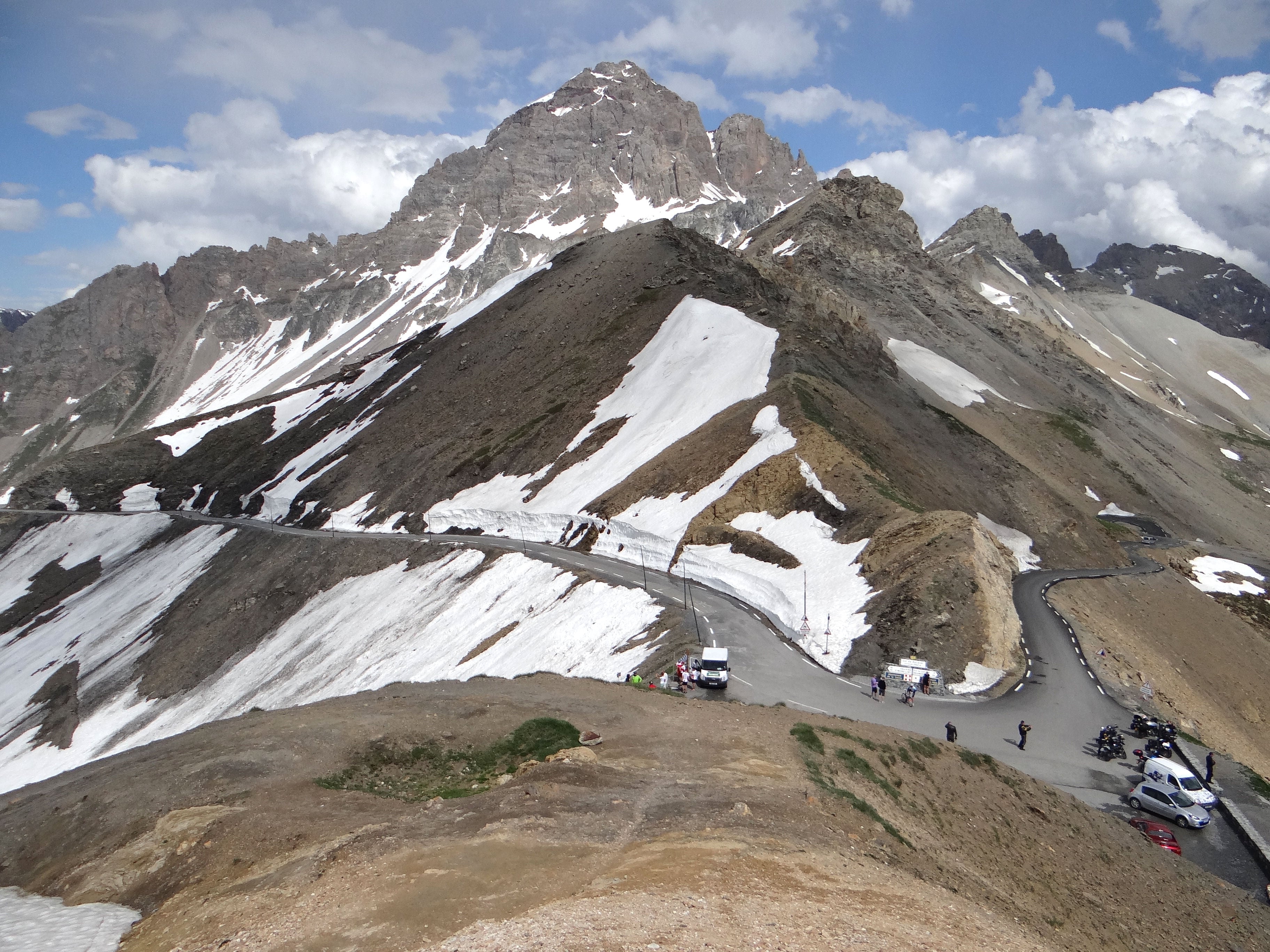
Col de l'Iseran
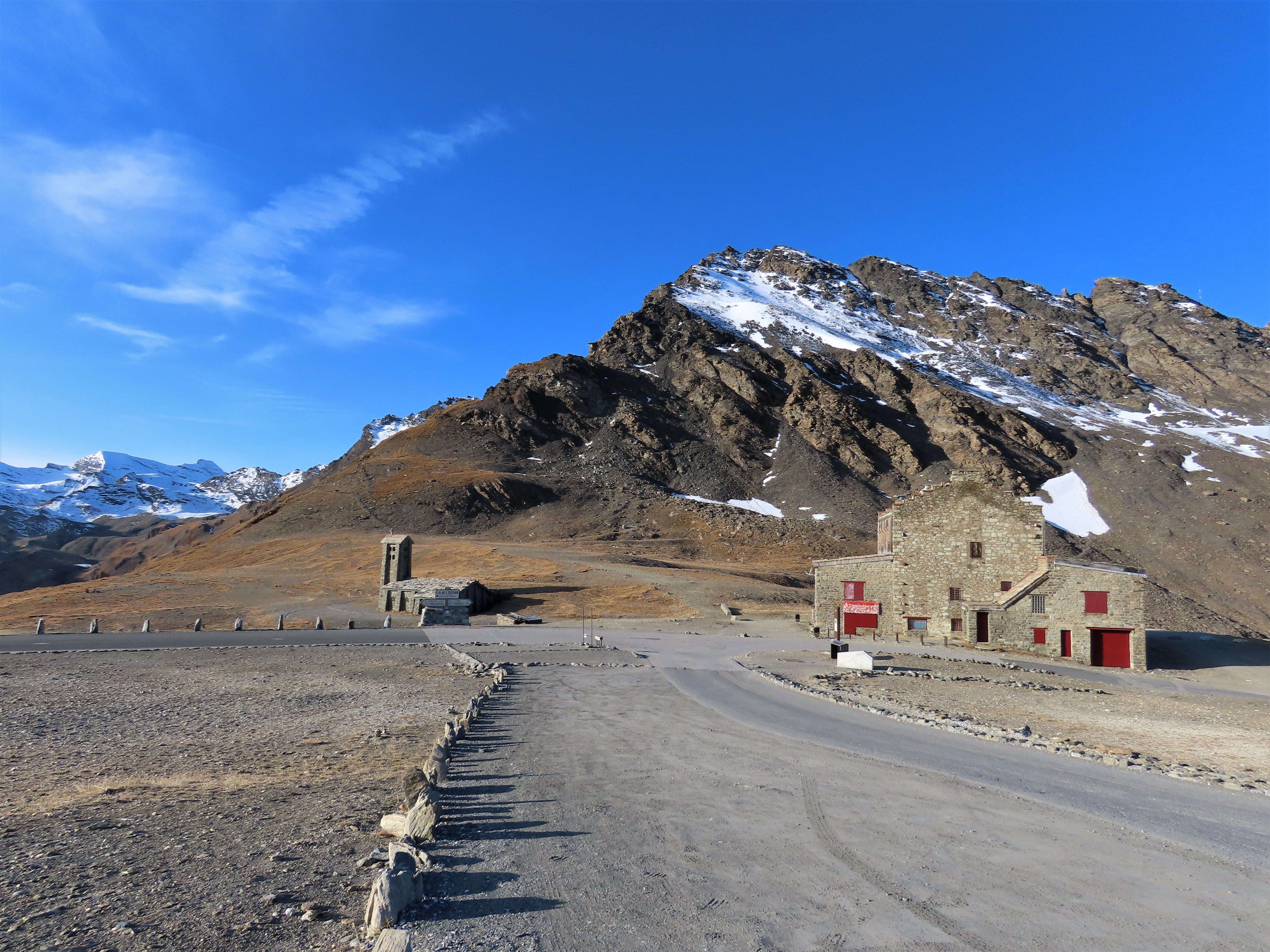
Why it's legendary
The highest paved pass in the Alps -2,764 m. The Iseran is a beast of length and altitude rather than gradient. The Tour doesn't use it every year (weather and snow are factors), but when it does, it's an event. The landscape is raw and high; the air is thin.
Moments on the mountain
- 1938First crossing
The Iseran makes its debut the year the road is finished. Only a couple of dozen riders make it to the top without walking; the rest are lost in the cold.
- 1963Anquetil in command
Jacques Anquetil dominates the Iseran stage on the way to his fourth Tour. The highest point the race had reached to date, and the French TT specialist made it his own.
- 2019Cancelled by an ice storm
Egan Bernal attacks on the Iseran, takes the virtual yellow jersey over the summit -and then a hailstorm and mudslide stop the stage mid-descent. The race commissaires freeze the times at the top. He wins the Tour two days later in Paris.
The numbers
From Val-d'Isère (north): the final 15.9 km from the village, open and exposed. From Lanslebourg / Bonneval-sur-Arc (south): 32.9 km from Lanslebourg, or the steeper 13.4 km from Bonneval (7.3% avg, sections over 10%). The south is wilder and less busy.
How to get there
Bourg-Saint-Maurice (train), Val-d'Isère, or Lanslebourg-Mont-Cenis. Chambéry and Geneva airports. The pass is on the D902; open only in summer (often June–September).
Tips: Check opening status -snow can keep it closed into July. Altitude affects everyone -pace yourself. One of the best high-altitude experiences in European cycling.
Col de la Madeleine
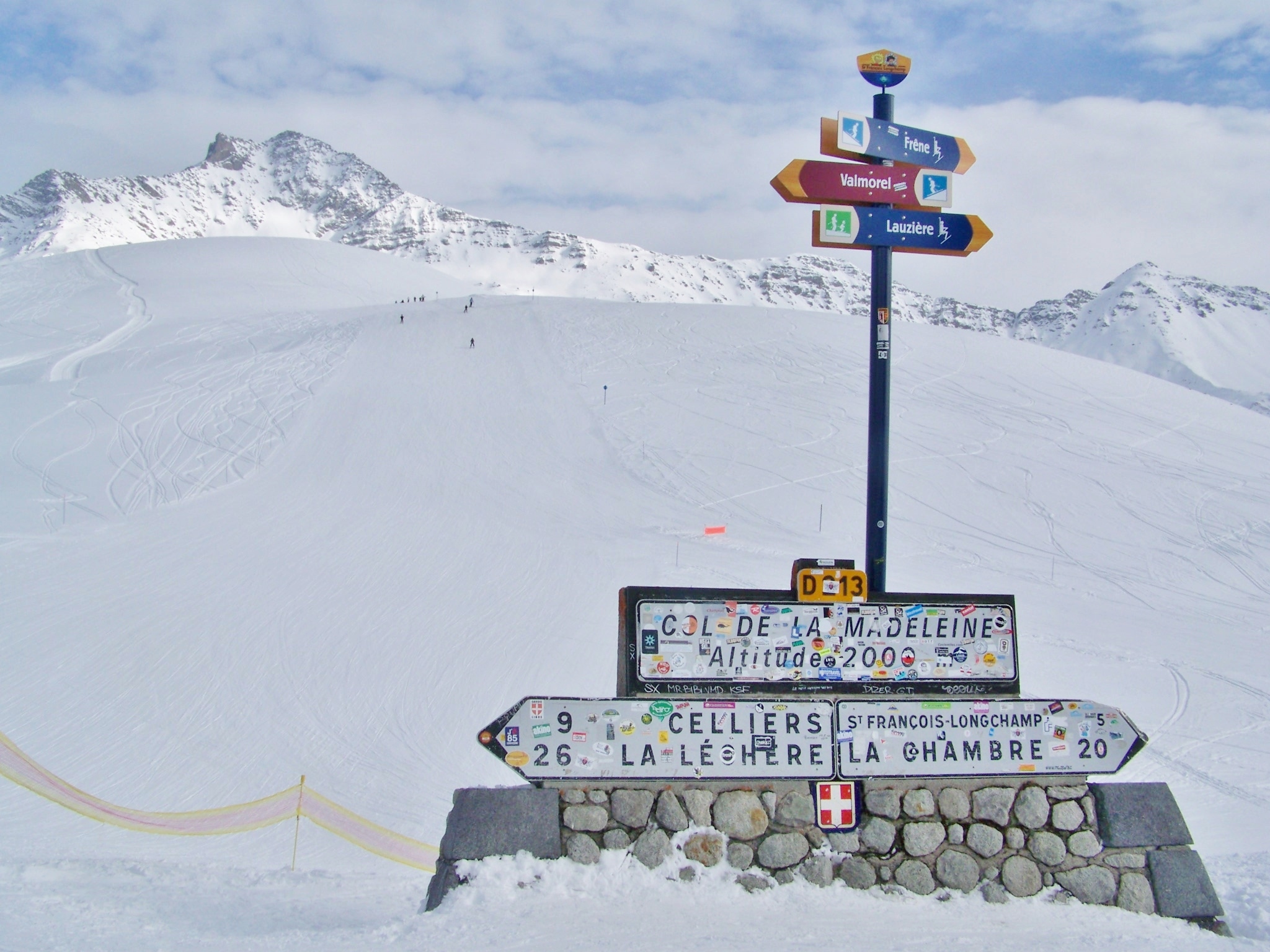
Why it's legendary
The Madeleine is a Tour regular -long, steady, and draining. It's not the highest or the steepest, but over 25 km the gradient adds up. The north side from La Chambre is the classic; the south from Aigueblanche is longer. Either way, it's a proper Alpine col that has decided many stages.
Moments on the mountain
- 1969Madeleine joins the Tour
The Madeleine features for the first time in 1969, Merckx's first Tour. It's been a regular ever since -a climb for rouleurs, not pure grimpeurs.
- 2010Contador vs Schleck warm-up
On a monster stage over the Madeleine, Contador and Schleck drop everyone. Later in the Tour, their infamous 'chaingate' incident rewrites the race.
- 2020Roglič and Pogačar together
Primož and Tadej ride over the Madeleine shoulder-to-shoulder, teammates in all but jersey. The Slovenian civil war is still two weeks away.
The numbers
From La Chambre (north): 25.4 km, the Tour's usual side -steady 6% with a few kicks. From Aigueblanche (south): 28.2 km, slightly gentler average. Both are HC in the Tour.
How to get there
Saint-Jean-de-Maurienne, La Chambre, or Moutiers. Chambéry and Geneva airports. The D213 (north) and D213 from the south serve the col.
Tips: A long climb -fuel and pace are key. Often combined with Col du Glandon or other Maurienne cols. The upper part is exposed; weather can change.
Col de Joux Plane
Why it's legendary
The Joux Plane is the sting in the tail -often used as the last climb before a finish in Morzine. It's not huge by Alpine standards, but the gradient never settles: ramps of 10–12% alternate with deceptive flatter sections, so there's no rhythm to find. Add a long day in the legs and it chews people up. The view over Mont Blanc from the top is unforgettable.
Moments on the mountain
- 1978The Joux Plane debut
The Joux Plane first appears in the Tour in 1978, immediately earning a reputation: short, brutal, no rhythm to find. Nothing has changed in fifty years.
- 2000Armstrong cracks
With Pantani pushing the pace off the front, Armstrong runs out of fuel and loses nearly two minutes to Ullrich and Virenque on the final ramps. He later calls it his worst day on a bike.
- 2016Izagirre down the rain
On a wet Joux Plane stage to Morzine, Jon Izagirre attacks off the summit and descends like a madman in the rain for a solo stage win. The descent is a reminder that the Joux Plane giveth and taketh away.
The numbers
From Samoëns (south): 11.6 km, steeper -8.7% average with sections near 12%. From Morzine (north): 11.8 km, slightly gentler. Both sides are Category 1. The summit is open with views of the Mont Blanc massif.
How to get there
Morzine, Samoëns, or Cluses. Geneva airport is about 1 hour. The D354 and local roads lead to the col.
Tips: Often the last climb of the day in the Tour -riders are on the limit. If you're doing it, save something for the steep middle section. Combine with Col de la Colombière for a classic Haute-Savoie loop.
Provence
Mont Ventoux
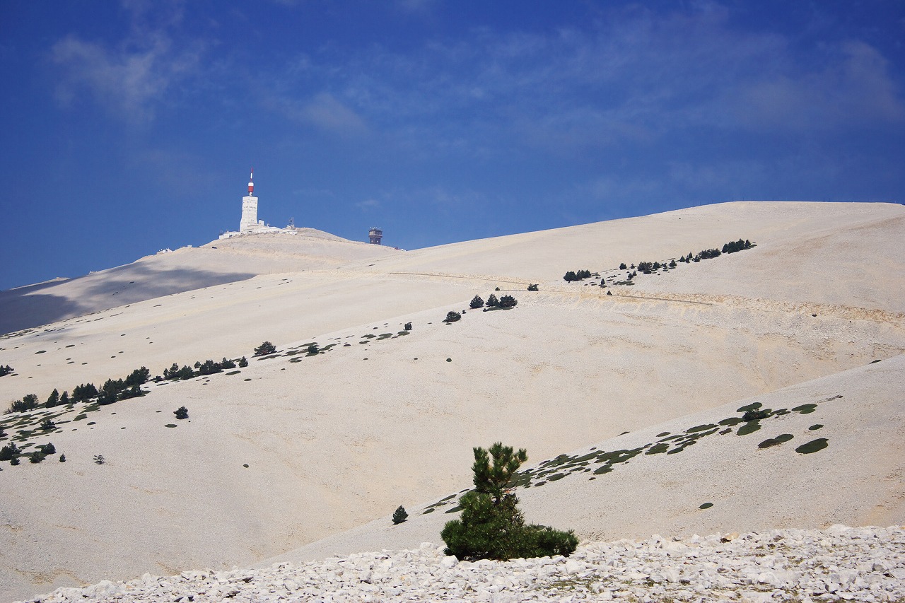
Why it's legendary
The Beast of Provence. The Bald Mountain. Ventoux isn't a col in the traditional sense -it's a standalone summit that dominates the landscape and has witnessed triumph and tragedy. The lunar landscape above the trees, the brutal Mistral wind, and the memory of Tommy Simpson (1967) make it unforgettable. When the Tour comes here, the whole of cycling holds its breath.
Moments on the mountain
- 1967Put me back on my bike
Tommy Simpson collapses and dies near the summit from a cocktail of heat, amphetamines and exhaustion. His memorial stone, half a mile from the top, has been a pilgrimage site for sixty years.
- 1970Merckx on oxygen
Eddy Merckx wins atop Ventoux and has to be given oxygen at the finish. Even the Cannibal admits it was the closest he ever came to blowing up.
- 2000The Armstrong–Pantani duel
Attack, counter, attack, counter, all the way up the bald summit. Armstrong freewheels across the line to give Pantani the stage. Pantani, publicly humiliated, never forgives him.
- 2016The day the wind won
Mistral gusts topping 100 km/h force organisers to shorten the finish from the summit down to Chalet Reynard. Breakaway king Thomas De Gendt solos to the stage win; behind him, a motorbike crash in the fan-choked road leaves Chris Froome bikeless and he jogs up in cleats while officials scramble. The jury freezes his time and he keeps yellow -one of the strangest days in Tour history.
- 2021Ventoux twice in a day
For the first time, the Tour climbs the Giant of Provence twice in one stage. Wout van Aert -cyclocross world champion, Classics winner, all-terrain freak -escapes on the second ascent, drops everyone on the climb he wasn't supposed to be able to follow on, and descends alone to Malaucène.
The numbers
Three routes. Bédoin (south) is the classic Tour side: 21.8 km, steepest in the middle through the forest, then the famous barren final 6 km to the weather station. Malaucène (north) is similar in difficulty. Sault (east) is longer but gentler until it joins the Bédoin road near Chalet Reynard.
How to get there
Carpentras or Bédoin are the usual bases. Avignon and Marseille have trains and are within about an hour. Marseille airport is the main gateway. The D974 (Bédoin) and D19 (Malaucène) lead to the summit.
Tips: Respect the Mistral -gusts on the exposed summit regularly exceed 100 km/h and can literally knock riders off. Early morning is usually calmest. Carry more water than you think: the 6 km above Chalet Reynard have no shade and no fountains. Allow 1h45–2h30 from Bédoin for a fit amateur. A 34x32 is the minimum for most. See our full guide: the complete guide to climbing Mont Ventoux.
Jura
Col du Grand Colombier
Why it's legendary
The 'new' legend. The Grand Colombier only joined the Tour in 2012 but has four very different ways up, one of which -the Directissime from Virieu-le-Petit -serves up ramps over 20%. It's in the Jura, not the Alps, so it has a different character: greener, less touristy, and quietly brutal. The 2020 summit finish put it on every climber's bucket list.
Moments on the mountain
- 2012The Tour arrives in the Jura
The Grand Colombier makes its Tour debut via Culoz -Thomas Voeckler takes the polka dots on home roads and a new legend is planted.
- 2020Pogačar's first stab at yellow
On the summit finish, Tadej Pogačar distances Roglič by seconds. It doesn't look decisive -until the time trial on the penultimate day flips the Tour upside down.
- 2023Pogačar again, for fun
Tadej comes back solo over the Directissime ramps in the rain, extending his lead and stamping his authority all over the Jura.
The numbers
Four sides, which makes the Grand Colombier a proper day out. From Culoz (south): 17.4 km at a steady rhythm, the most commonly used in the Tour -max around 12%. From Anglefort (north-east): 15.2 km, slightly steeper. From Virieu-le-Petit (the 'Directissime'): 13.5 km with sustained sections at 14–18% and ramps hitting 22% -this is the one you've seen in the viral photos. Whichever side you choose, the summit feels exposed and the views over Lake Bourget are worth the suffering.
How to get there
Culoz (train from Lyon or Geneva), or drive from Lyon (about 1.5 hours). Geneva airport is handy. The col is in the Ain department; D120 from Culoz, D904 and minor roads from the other sides.
Tips: If you're riding the Directissime, a 34x32 is the minimum -a 34x34 or lower will save your knees. The Culoz side is the 'civilised' option for a first visit. Less traffic than the Alps, but in July the road is narrow and you'll share it with cars. Usually open from April/May; check local conditions as the top can stay cold.
Honorable mentions
These didn't make our 15 but every one is a proper Tour climb in its own right -and a serious day out. If you've already ticked off the giants, start here next.
La Planche des Belles Filles
1,148 mVosges
7 km · 8.5% avg · 24% max (gravel finish)
A 2012 newcomer that delivers spectacle every single time: Froome's maiden Tour stage win; Pogačar's 2020 time-trial ambush of Roglič; Vingegaard's 2022 demolition of Pogačar. The 'super' gravel kick at the top is where Tours are decided.
Hautacam
1,560 mPyrenees
13.5 km · 7.8% avg · 10% max
Site of Riis' 1996 demolition and Pogačar's 2022 answer to Vingegaard.
Plateau de Beille
1,780 mPyrenees
15.8 km · 7.9% avg · 11% max
Merciless summit finish in the Ariège; every rider who's won here has won the Tour that year.
Col du Granon
2,413 mAlps
11.3 km · 9.2% avg · 12% max
Forgotten for three decades until 2022, when Vingegaard cracked Pogačar open here.
Col de la Loze
2,304 mAlps
21.5 km · 7.8% avg · 24% max
Bike path 'surprises' -ramps past 20% near the top broke everyone in 2020 and 2023.
Cormet de Roselend
1,968 mAlps
20.3 km · 6% avg · 8% max
The lake and the descent alone are worth the detour; a Savoie classic.
Col de la Colombière
1,613 mAlps
16.3 km · 6.8% avg · 11% max
Haute-Savoie staple, often the launchpad for Joux Plane days.
Col du Lautaret
2,058 mAlps
34 km · 3.8% avg · 7% max
Mostly a gateway to the Galibier, but a big climb in its own right from Grenoble side.
Lacets de Montvernier
782 mAlps
3.4 km · 8.2% avg · 10% max
17 hairpins stacked into a cliff -short, and the most photogenic 10 minutes in cycling.
Col d'Aubisque via Soulor
1,709 mPyrenees
Soulor + 10 km of balcony road
Not a separate climb but the 'corniche' section past Soulor is one of the great roads anywhere.
Superbagnères
1,804 mPyrenees
18.4 km · 6.3% avg · 12% max
Ski-station finish above Bagnères-de-Luchon; a regular in older Tours.
More on nearby climbs in our 50 brutal climbs in Europe, or the dedicated guide to climbing Mont Ventoux. Whatever your target: check opening dates, weather, and local advice before you go -these mountains demand respect.
Hendrik Bulens
The average cyclist exploring cycling routes worldwide, particularly in Andalucía, Spain. Sharing expert guides on scenic bike routes for regular cyclists planning their next adventure.
Ride these routes
Routes from the area mentioned in this article.


Tourmalet
One of the all-time greats.


Mont Ventoux
The giant of the Provence is strictly not speaking in the Alps, but it's close enough to feature in this section.


Lacets de Montvernier & Croix de Fer
Few places on earth can beat a warm up ride in the Lacets de Montvernier, before tackling the Alp giant of Col de la Croix de Fer.
Related Articles
The legendary cols of the Tour de France
15 iconic climbs that define the Tour: where history was made, stats that matter, the route to the top, and how to get there. From the Tourmalet to Alpe d'Huez, Galibier to Ventoux.

50 brutal climbs in Europe
Savage gradients, endless kilometers, lung-crushing altitude, and treacherous cobbles - here are 50 killer climbs that you may (not) want to put on your bucket list.

10 epic road rides in Andalucía
Discover 10 epic road cycling routes in Andalucía, Spain. Perfect for scenic rides, challenging climbs, and unforgettable cycling adventures.