This loop is a true Alpine classic - combining the sheer spectacle of the Lacets de Montvernier with the long, grinding ascent of the mighty Col de la Croix de Fer. It’s a ride that feels like ticking off two bucket list climbs in one day, and it delivers on every front: beauty, challenge, and pure satisfaction.
Route
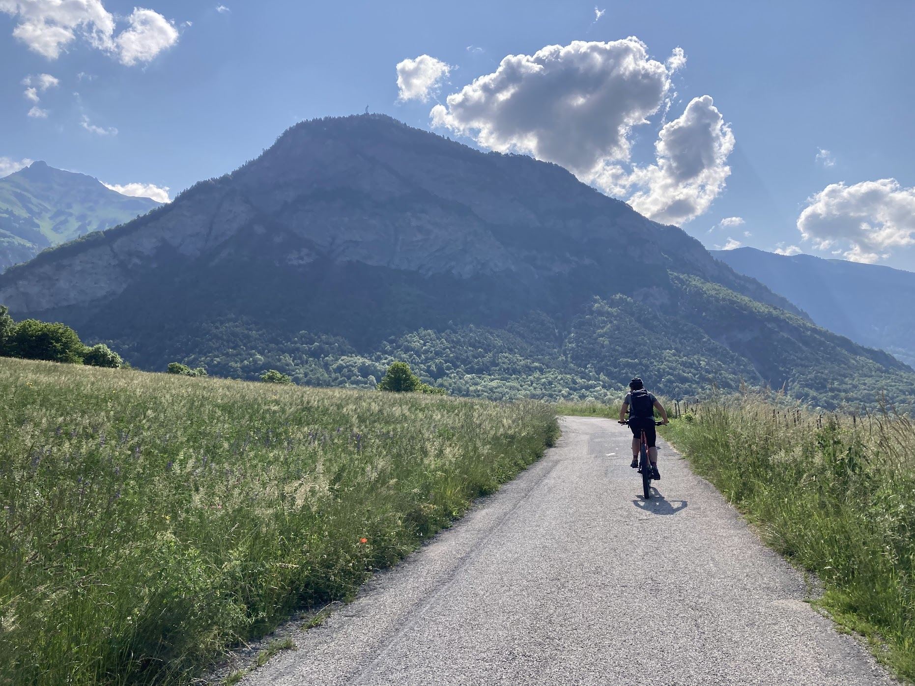
You start off almost immediately with the Lacets de Montvernier - one of the most picturesque climbs anywhere in the Alps. The famous “laces” (lacets) wind their way up the cliff face with a ridiculous density of hairpins, around 18 in total, stacked right on top of each other. The climb isn’t long - about 3.5 km - and it’s not steep by Alpine standards, hovering around 8%.
Due to its length and the many hairpins, this doesn’t feel much like a tough climb. And also, the stunning views over the Maurienne Valley make it impossible not to stop for a few photos.
Once you top out and roll through the tiny village of Montvernier, the ride continues more gently across open countryside before dropping into a fast descent toward Saint-Jean-de-Maurienne. From there, the real work begins: the climb to Col de la Croix de Fer.
It’s a long haul - around 30 kilometers of mostly uphill - and it’s a climb that throws a bit of everything at you. Early on, the gradients are fairly steady, winding along a scenic river valley. As you gain altitude, the road narrows, the air cools, and the views start to open up dramatically. You’ll pass through classic Alpine villages, waterfalls, and pastures dotted with cows.
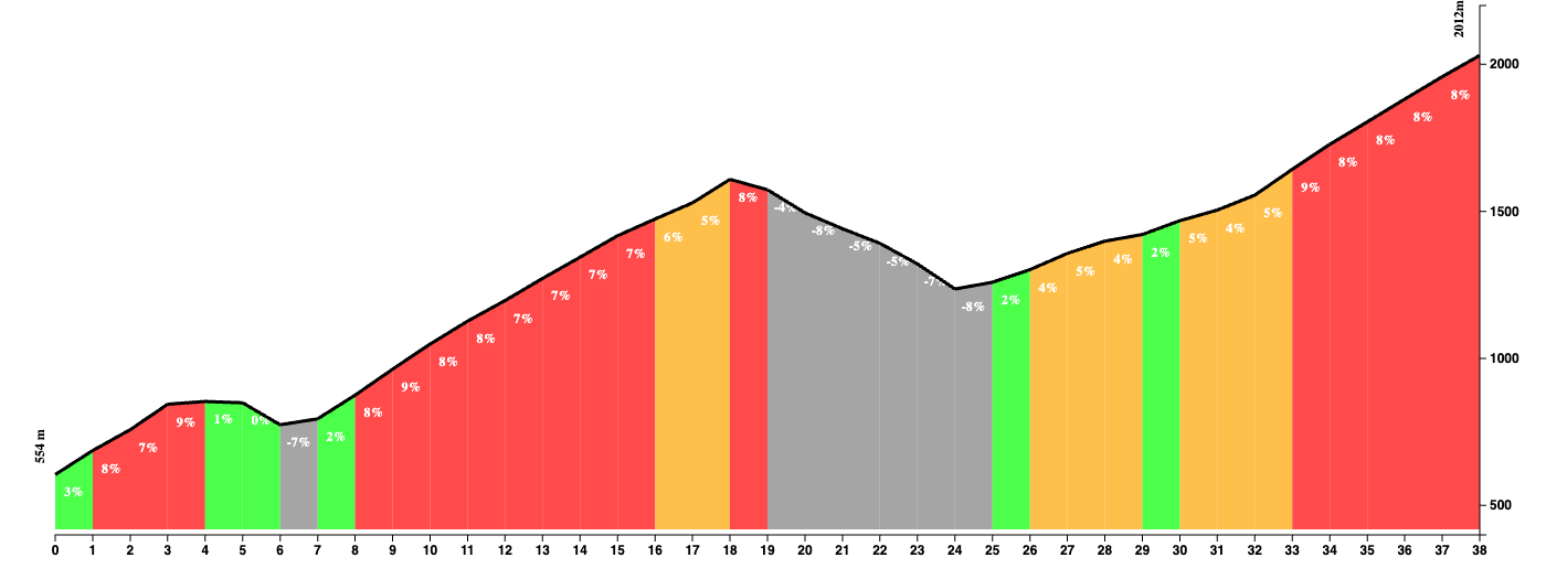
The middle section, which according to the map is classified as a separate climb, the Col du Mollard, is tough, with gradients consistently hovering around 7–9%. The roads are empty, and the landscape becomes more rugged and wild as you climb higher and higher. It’s exposed here too, so if the sun’s out, you’ll feel it.
The final stretch toward the summit of Croix de Fer is a mental and physical grind. The last few kilometers, especially when you leave the final ski town, are steep and drag on longer than you think, especially when the summit seems to hang just out of reach.
At the summit (2,067 meters), you’re rewarded with a jaw-dropping panorama of jagged peaks all around you. From here, it’s (mostly) downhill back toward civilization - a long, technical and fast descent of the Col du Glandon where you’ll want to keep your wits about you, especially since the road surface isn’t that great.
Fueling up
Saint-Jean-de-Maurienne is a decently-sized town with ample opportunities for a break. At the top of the Croix de Fer is a restaurant, although it was closed when I was there early June of 2023.
Tips
This loop is no joke: expect a big day out with a lot of climbing, changing scenery, and a proper Alpine atmosphere. Altitude, too, will play its role: respect +2000m mountains when riding your bike.
You Might Also Like


Mont Ventoux
The giant of the Provence is strictly not speaking in the Alps, but it's close enough to feature in this section.


Tourmalet
One of the all-time greats.

Gran Fondo
Monster ride featuring Col de Spandelles, Col du Soulor, Aubisque, and Hautacam.
Read more
Articles covering this route, region, or country.