The only reason why you’d want to do this ride is the climb to Moclín, and Moclín itself of course. This ride starts and finishes in Granada, but as getting in and out of this city is not the most pleasant experience, you might as well take your car and start the ride in places like Olivares and Parque del Cubillas.
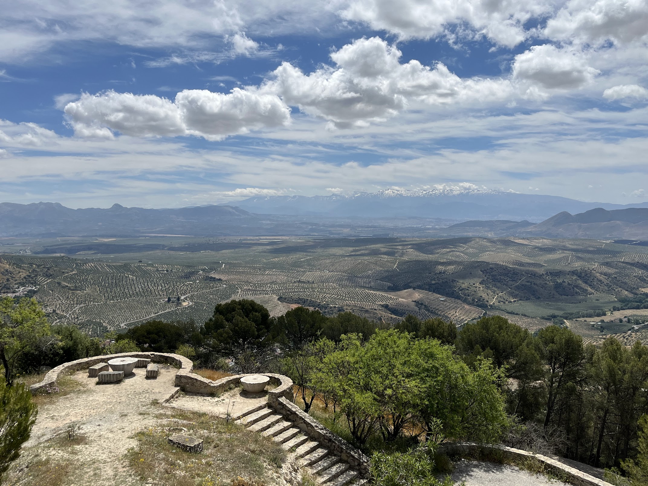
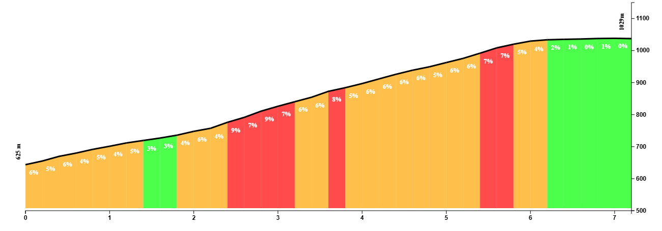
What you won’t want to miss is the climb to Moclín. Butter-smooth tarmac, hairpins, spectacular views of the Sierra Nevada, this climb has got it.
The climb is steady and not overly difficult. This being Granada, the heat might be your worst enemy as it can get sweltering hot in this part of the world.
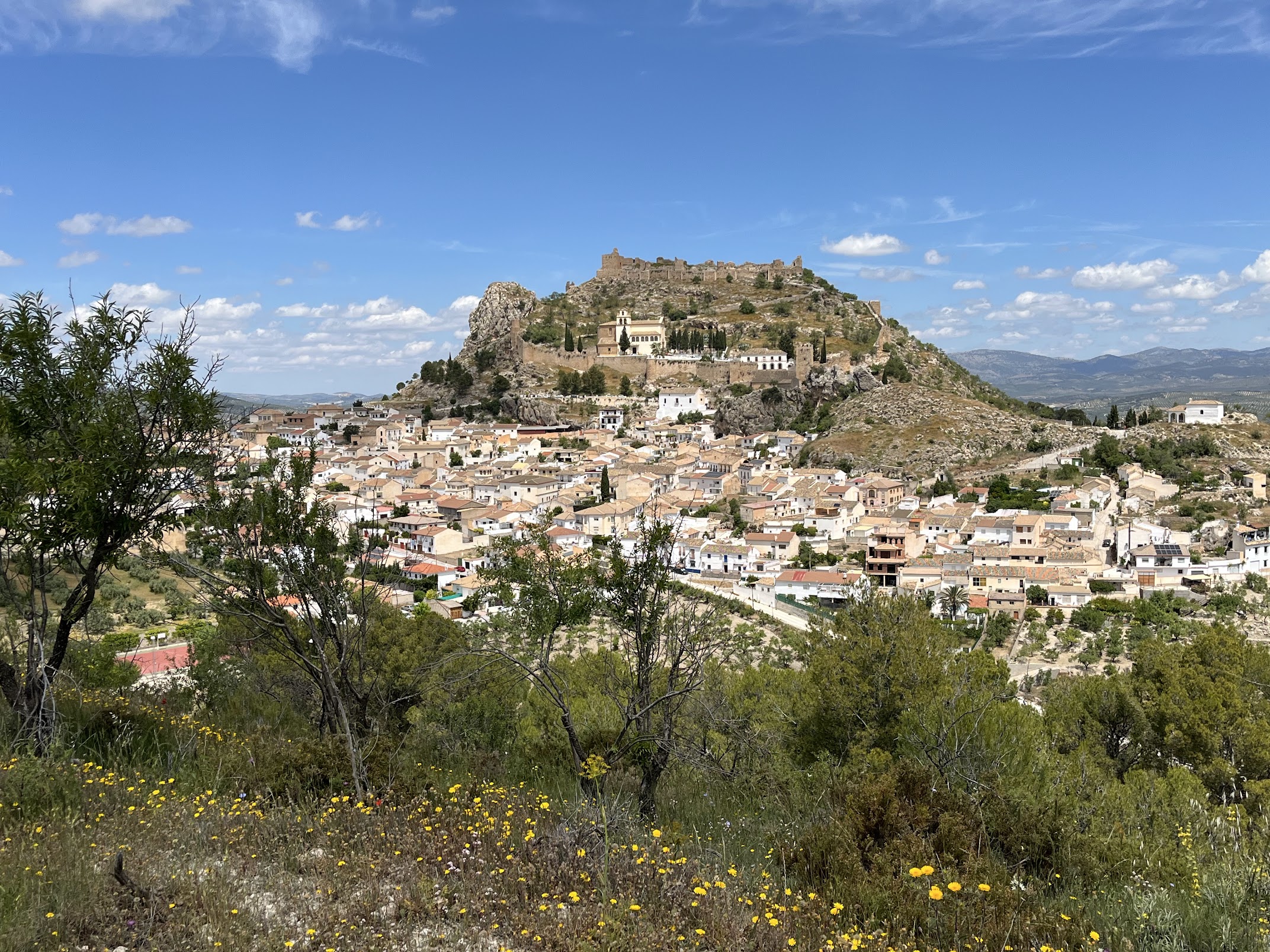
What awaits you at the end is the cherry on the cake: Moclín, and specifically the Moorish castle perched on the top of the hill, is quite something to behold.
You can return to Granada the same way you came, or loop around the mountains of Moclín and head back via the A-4076 through towns like Colomera.
You Might Also Like


Haza del Lino
Not yet discovered by the masses, this is a gem of a ride.


Ruta de la Cabra
The Goat's Path is an absolute beauty and must-do when you're in the area.


Sierra de Tejeda
One of the favorite loops of the pros when preparing for the Tour de France.
Read more
Articles covering this route, region, or country.

Top 5 cycling routes in Granada
Explore the best cycling routes in Granada. Snow-capped mountain climbs, empty valleys, butter-smooth roads, and historic cities are perfect for your next cycling holiday in Spain.

10 epic road rides in Andalucía
Discover 10 epic road cycling routes in Andalucía, Spain. Perfect for scenic rides, challenging climbs, and unforgettable cycling adventures.

Top 5 cycling routes in Málaga
Explore the best cycling routes in Málaga. Sunny coastal rides, mountain climbs, and scenic roads perfect for your next cycling holiday in Spain.