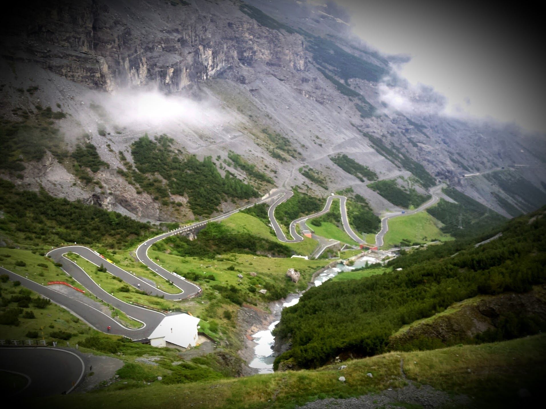
The Passo dello Stelvio is a crown jewel of alpine cycling. It’s a road steeped in legend, beauty, and brutal elevation. While most photos show the famous switchbacks from the Prato side, the climb from Bormio is every bit as spectacular - arguably more dramatic, with cliffside tunnels, glacial waterfalls, and sweeping views into the heart of the Italian Alps.
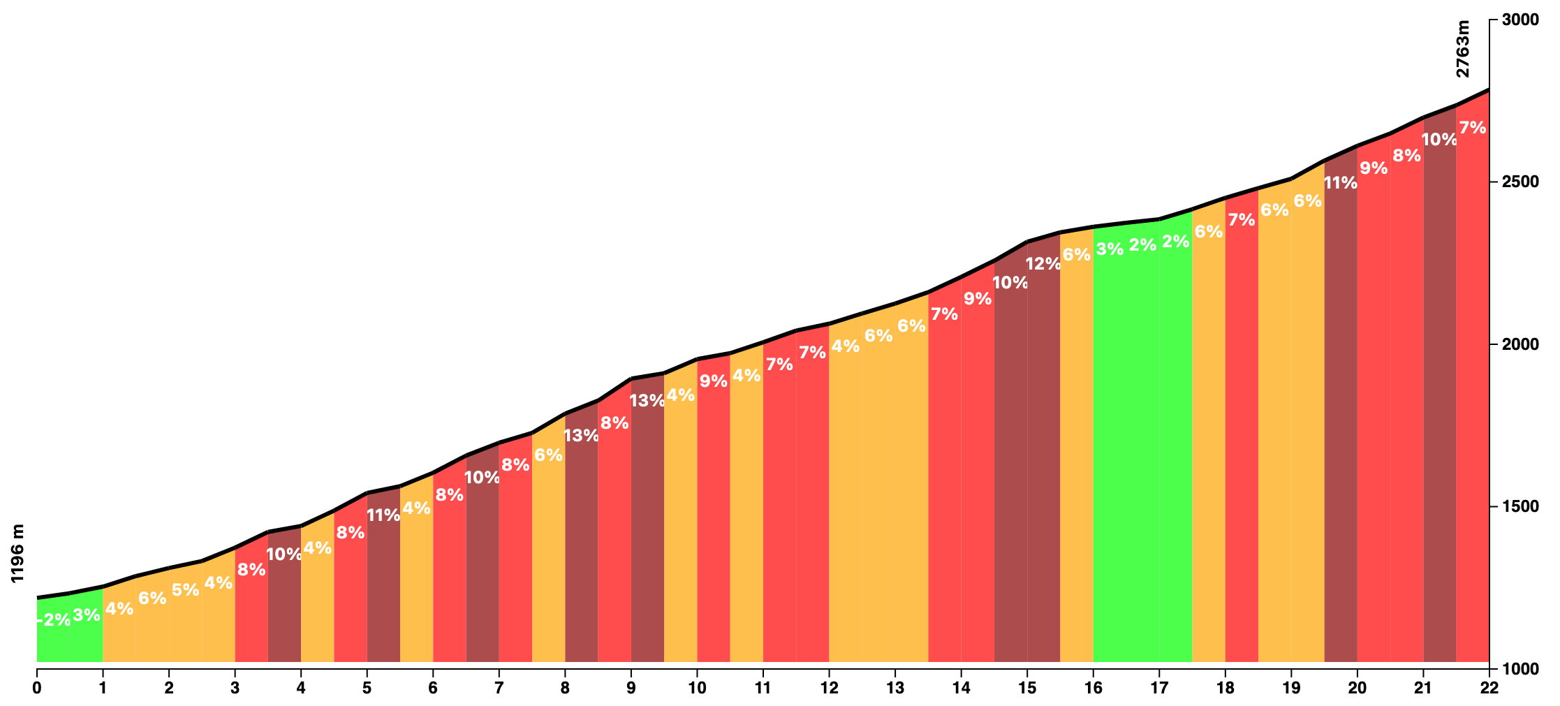
The route starts in the town of Bormio, a popular spa destination surrounded by jagged peaks. From the very first kilometer, the road begins to rise - steadily and without mercy. The gradient averages around 7%, but expect frequent stretches between 8–9% and the occasional sharp ramp.
The road carves its way up through a high alpine gorge, often hugging rock faces and ducking into dark, narrow tunnels blasted into the cliffs. This side of the Stelvio feels raw and wild - a proper mountain road with a distinct sense of scale. You’ll cross ancient stone bridges, ride past cascading waterfalls, and catch glimpses of the Ortler massif as you gain elevation.
Around the halfway mark, the landscape begins to open up. The switchbacks become more defined, and soon you’ll be riding above the tree line, surrounded by alpine meadows and scree-covered slopes. With every turn, the air gets thinner and the summit closer.
At 2,758 meters, the Passo dello Stelvio is the second-highest paved mountain pass in the Alps. The summit is marked by cafés, a few souvenir stands, and usually dozens of cyclists from around the world, all soaking in the moment. You can descend the same way to Bormio, or continue over the top toward Prato allo Stelvio - or even make a loop via the Umbrail Pass into Switzerland.
You Might Also Like


Passo di Gavia
That other monstrous climb in the Dolomites.


Serra de Monchique
Tackle the biggest climb in the Algarve – the Fóia climb in the Serra de Monchique. Ride the famous climb of the Tour of Algarve professional race.


Calar Alto
Epic climb to the otherworldly Calar Alto Observatory.